5-day Tour In Mangystau
About this tour
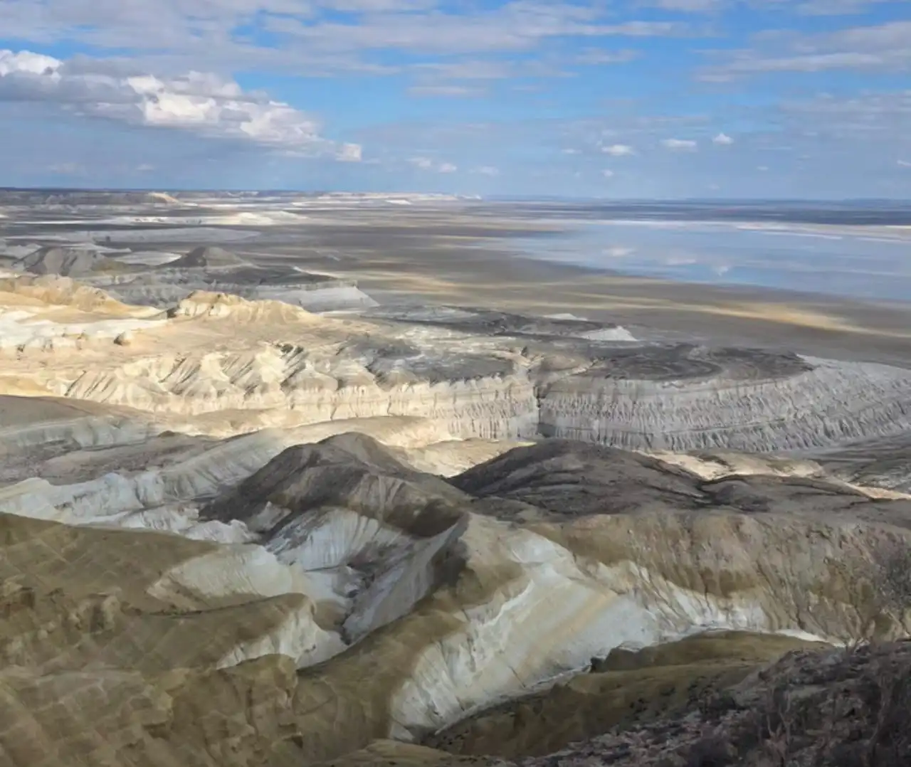
This 5-day jeep tour explores the most iconic places of Mangystau, starting and ending in Aktau. The route includes deserts, canyons, salt flats, ancient underground mosques, and surreal rock formations shaped by millions of years of geology.
Travelers visit Shakpak-Ata and Sultan Epe mosques, Zhygylgan, Saura Gorge, Torysh Valley, Sherkala Mountain, Ayrakty Valley, Tuzbair salt flats, Black Canyon, Sphinx Panorama, Bozzhyra, Mount Bokty, and Kyzylkup (Tiramisu Mountain).
This is a full off-road expedition through the most unique and otherworldly landscapes of Kazakhstan.
Day-by-day itinerary
Day 1: Актау, Казахстан to Saura Aktau, Актау, Казахстан
08:00-Departure from Aktau 09:30 - Tauchik village Since ancient times (medieval nomadic routes), this area served as a transition zone between the steppe and the Ustyurt Plateau. Today it is the border where the “wild” part of the region begins. Transfer: 100 km - 1 hour 30 minutes Stop, restroom, short rest - 15 minutes 10:35 - Shokpak-Ata Canyon panorama 60-40 million years ago, this territory was the bottom of the Tethys Ocean, so the rocks consist of ancient marine deposits. Later, wind and water carved narrow canyons with unusual shapes. Transfer: 23.2 km -49 minutes Photo stop at canyon panorama - 20 minutes 11:45 - Shokpak Ata underground mosque. 14th century - the period of the spread of Sufi culture in Mangystau. The underground mosque was carved into chalk rock as a place for solitude and spiritual practice. Transfer: 7.2 km - 17 minutes Walk around the mosque and surrounding area - 40 minutes 12:45 - Kapamsay Canyon Its formation began millions of years ago from sedimentary rocks of the ancient sea. Over time, erosion created narrow passages and rock walls. Walk, lunch, panoramic views from above, photo stops Total time at the location - about 2 hours 15:00 - Sultan Epe Mosque 14th century — a period of the spread of Sufi culture in Mangystau. The underground mosque was carved into chalk rock as a place of solitude and spiritual practice. Transfer: 22.6 km - about 40 minutes Walk and exploration of surroundings - 1 hour 16:40 - Zhygylgan (Fallen Earth) A geological collapse from an ancient period - the sinking of a large area due to underground limestone cavities. It is one of the rarest natural depressions in the region. Transfer: 39 km - about 1 hour Hiking trail about 1 km, ancient footprints of a two-toed horse and a saber-toothed tiger, photo stops 18:30 - Saura Gorge Formed as a natural oasis in a desert zone over thousands of years. Water sources made it a rare green area among the rocks. Transfer: 50 km - 1 hour 17 minutes Wild beach by the sea, sunset, overnight stay in a traditional yurt
Day 2: Saura Aktau, Актау, Казахстан to Этноаул Көгез (Etno-aul Kogez), Шетпе, Казахстан
08:00 - Breakfast 08:30 - Departure from Saura 08:35 - Arrival Turtle Lake - formed as a result of natural processes in a rocky depression. It is a rare freshwater area in arid Mangystau. Transfer: about 1 km - 5 minutes Walk, freshwater turtles - 40 minutes Torysh 60–20 million years ago — part of the ancient ocean floor where concretions (stone spheres) formed. Their exact origin is still not fully explained, which adds mystery. 09:20 - departure 11:00 - Valley of Balls arrival Transfer: 108 km - 1 hour 40 minutes Arrival at spherical concretions, walk and photo stops - 1 hour Kokala Sedimentary rocks of different geological periods formed a layered relief. The color layers reflect different stages of Earth’s formation. 12:01 - departure Transfer: 37 km - 43 minutes 12:44 - arrival Jurassic-period landscape, walk - 30 minutes Sherkala Formed millions of years ago from marine deposits of the ancient ocean. In the Middle Ages, it served as a natural landmark for nomads and caravans. 13:14 - departure Transfer: 18 km - 28 minutes 13:42 - arrival Mountain sightseeing, photo stops - 40 minutes Ayrakty Formed due to long-term erosion of chalk rocks. In ancient times, it was part of natural navigation landmarks along steppe routes. 14:22 - departure Transfer: 171 km - 2 hours 15 minutes 16:37 - arrival Valley of Castles, panoramas and photo zones - 1 hour Ethno-aul Kogez A modern reconstruction of nomadic culture based on traditions of the 18th–19th centuries. It recreates the lifestyle of Kazakh nomads. 17:37 - departure Transfer: 166 km - about 2 hours 19:37 - arrival Accommodation and overnight stay in a traditional yurt
Day 3: Этноаул Көгез (Etno-aul Kogez), Шетпе, Казахстан to Сор Тузбаир, Say-Utes, Казахстан
08:00 - Breakfast at the camp 09:00 - Departure from Ethno-aul Kogez 09:30 - Shetpe village A modern settlement formed in the 20th century as a regional transport hub. Today it serves as a starting point for natural attractions. Transfer: 15 km – 20-25 minutes Fuel stop for vehicles, short break Black Canyon Formed millions of years ago due to tectonic processes and erosion. Dark rocks create a sharp contrast with the surrounding landscape. 10:00 - arrival Transfer: 20 km - 30–35 minutes Walk - 40 minutes A narrow rocky canyon with dark rock formations and a sharp relief, photo stops Tuzbair (salt lake panorama) 40-60 million years ago - the bottom of an ancient sea, later turning into a salt plateau. Today it is one of the flattest and whitest landscapes in the region. 11:30 - departure from Black Canyon Transfer: 110 km - 1 hour 12:30 - arrival Photo stop - 20 minutes White salt flats and panoramic views of Mangystau Sphinx Panorama Shaped naturally by wind and water erosion over millions of years. The rocks resemble silhouettes of animals and figures. 12:50 - departure Transfer: 1 km - 2 minutes 13:00 - arrival Walk - 40 minutes Rock formations “Sphinx”, fossil hunting (ancient shark teeth)
Day 4: Сор Тузбаир, Say-Utes, Казахстан to Бозжыра, Актау, Казахстан
08:00 - Breakfast 08:30-10:30 - Walk to Tuzbair Arch and the salt lake Formed by the weathering of chalk rocks over millions of years. Today it is a natural arch with a panoramic view of the plateau. Viewing remains of ancient sea urchins Total walking time - about 2 hours 10:30-15:30 - Transfer to Bozzhyra Distance: 370 km - 5 hours 32 minutes 15:32-17:32 - Exploration of the three upper viewpoints of Bozzhyra 60-40 million years ago - the seabed of the ancient Tethys Ocean. Today it features chalk towers and cliffs shaped by wind and time. Total time - about 2 hours Photo stops and panoramic viewpoints 17:30-18:00 - Transfer to Bozzhyra Canyon Part of the Ustyurt Plateau, formed through erosion and tectonic uplift. Its depth and scale create a “another planet” effect. Distance: about 20–25 km — 30 minutes 18:02–20:00 - Hiking and camp Hiking route: about 1 km to the central part of Bozzhyra Setting up camp, rest, overnight stay
Day 5: Гора Бокты, Казахстан to Актау, Казахстан
08:00 - Breakfast at the camp 09:00 - Departure 09:00-10:00 - Transfer to Mount Bokty and Kyzylkup Formed from sedimentary rocks of an ancient sea millions of years ago. Its isolated shape makes it a distinctive landmark on the plain. Distance: 43 km — 1 hour Photo stop at Mount Bokty and walk Kyzylkup (“Tiramisu”) - about 1 hour The mountain layers formed from different geological periods, each layer representing a separate stage of time. This creates a “layered dessert” visual effect. 11:00–12:40 - Transfer to Zhanaozen Distance: 104 km - 1 hour 30 minutes Lunch at a café 12:40-14:25 - Transfer Zhanaozen → Aktau 20th century — developed as an oil industrial city. Before that, the area was used as nomadic steppe land. Distance: 151 km 1 hour 45 minutes Return to Aktau - 14:25 A modern 20th–21st century city built as a port and industrial center. Today it is the main maritime gateway to the Mangystau region.
What's included
Stay in tense
Languages spoken
Route & locations
Актау, Казахстан to Saura Aktau, Актау, Казахстан