Bishkek - Osh
About this tour
Enjoy one of the world’s best destinations for mountain treks
Day-by-day itinerary
Day 1: Bishkek, Kyrgyzstan to Cholpon Ata, Kyrgyzstan
Transfer to Burana Tower from 9th of century which is a large minaret in the Chuy Valley in northern Kyrgyzstan. All that remains of the ancient city of Balasagun, which was established by the Karakhanids at the end of the 9th century.
Day 2: Cholpon Ata, Kyrgyzstan to Altyn-Arashan, Kyrgyzstan
Altyn-Arashan is a high mountain gorge in the eastern part of the Terskey-Ala-Too mountain range, located near the city of Karakol. This gorge is one of the most popular tourist places in Kyrgyzstan due to its unique nature, hot springs, spruce forests and stunning views. All the year-round, the water temperature is 35 degrees for the radon source and 41 degrees for hydrogen sulfide. Some sources are in indoor pools, while others are “wild” to this day, located in hollows or grottoes carved into stones.
Day 3: Altyn-Arashan, Kyrgyzstan to Karakol, Kyrgyzstan
Karakol is strikingly different from all other cities of Kyrgyzstan due to its amazing old-Russian architecture. It was founded in the XIX century, the city for a long time was the largest and most developed city in Kyrgyzstan. Now it is an authentic capital of the Issyk-Kul region, which combines the cultural differences of peoples who lives there. Karakol is located in an amazing place, right under the high mountains of the Terskey-Ala-Too range. This is one of the most geographically diverse corners of Kyrgyzstan, where a relatively small area has a huge amount of natural beauty.
Day 4: Karakol, Kyrgyzstan to Jeti Oguz, Kyrgyzstan
Drive to Jeti Oguz is a sandstone formation about 25 km (15 miles) southwest of Karakol. The name means “seven bulls”, which comes from the fact that the rocks look like seven bulls. Jeti-Oguz Rocks are a protected Nature Monument.
Day 5: Jety - Oguz, Kyrgyzstan to Kochkor, Kyrgyzstan
Chychkan Gorge is a long and picturesque gorge in the northern part of the Jalal-Abad region, through which the Bishkek-Osh road passes. Perhaps everyone who traveled from Bishkek to Osh by car remembered this remarkable place well. A wooded gorge, the slopes of which are covered with Tien Shan spruce, flowers and thickets of mountain berries leave few indifferent. Chychkan in translation f rom Kyrgyz means "mouse."
Day 6: Kochkor, Kyrgyzstan to Tash-Rabat, Kyrgyzstan
Tash-Rabat is an ancient caravanserai located in the territory of Naryn region, not far from the border with China. It was one of the key parts of the ancient Great Silk Road. The caravanserai is located at an impressive altitude of 3100 meters in the southern part of the At-Bashi ridge. Numerous caravans laden with oriental goods from China had been founding shelter for centuries here. The history of Tash-Rabat goes back to ancient times
Day 7: Tash-Rabat, Kyrgyzstan to Song-Kul, Kyrgyzstan
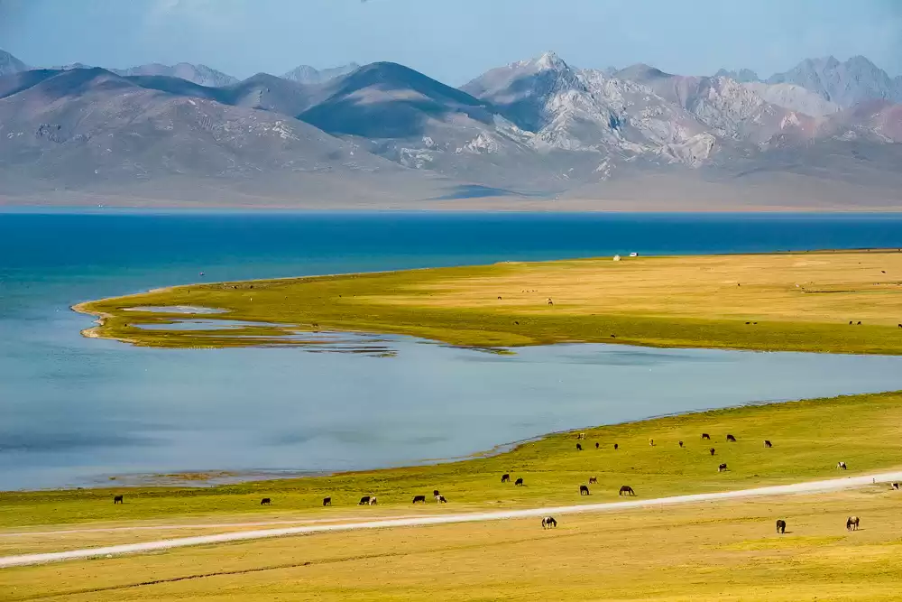
Son-Kul Lake is the second largest lake in Kyrgyzstan, Son-Kul is located at an altitude of 3000 meters in a large inter-mountain valley, surrounded from the north by the Sonkul-Too Ridge and the Moldo-Too Ridge from the south. The lake is cold and quite deep – the maximum depth of the lake is 14 meters. Son-Kul freezes approximately in mid-November and melts only by mid-April. The area around the lake is very picturesque, especially in summer. Hills and snowy peaks of the Central Tien-Shan ridges surround Son-Kul. Due to the high altitude, there are no trees, only low hard grass and edelweiss can grow in these conditions.
Day 8: Song-Kul, Kyrgyzstan to Kyzyl-Oi, Kyrgyzstan
Chaek is a village in Naryn Region of Kyrgyzstan on the A361 highway which crosses the north of the region. It is the center of the Jumgal District. It is about 100km west of Kochkor and 45km west of Lake Son-Kul. It is the largest of several villages in an agricultural valley. Further west the scenery becomes more dramatic.
Day 9: Kyzyl-Oi, Kyrgyzstan to Toktogul, Kyrgyzstan
The Toktogul Reservoir is one of the largest reservoirs in Central Asia, located in the northern part of the Jalal-Abad Region.The construction of the reservoir began in 1965. The area of the man-made lake is almost 300 square kilometers, occupying the intermontane depression among clay hills. The average depth of the reservoir is 200 meters. The largest river in Kyrgyzstan – the Naryn River, flows into the reservoir. There are two large hydropower stations – Toktogul and Kurpsay. The bright blue color of the water creates an amazing contrast with the clay hills around.
Day 10: Toktogul, Kyrgyzstan to Arslanbob, Kyrgyzstan
The vast tracts of woodland, filled with nut and fruit trees, in the Arslanbob River valley are the largest of their kind in the world, covering over 600,000 hectares. Up to 1,500 tons of walnuts are harvested every year in the Arslanbob Valley, plus 5,000 tons of apples, pistachios, and cherry plums. In order to protect these generous gifts of nature, the Arslanbob area is now a forest zone protected by the state. Recent deforestation (despite the fact that the forests are protected by law) has been very controversial.
Day 11: Arslanbob, Kyrgyzstan to Osh, Kyrgyzstan
The date of the origin of the Uzgen city is attributed to the 1-2 centuries BC. He served as one of the trade points of the Great Silk Road, which connected Europe and Kashgar in China. Most interesting sight of Uzgen is the architectural complex, built in the early 12th century. Visiting the historical places Asaf ibn Burhia, Babur’s house on the top of Sulayman mountain, mosque Rabat Abdulahan from 16th of century.
Day 12: Osh, Kyrgyzstan to Tulpar kul, Sary Mogul, Kyrgyzstan
In the morning drive to Tulparkul lake and you will cross two passes Taldyk (the highest pass in Kyrgysztan and Chyirchyk passes which is surrounded with shepherd’s yurts.) In Tulparkul lake there are some small lakes. From that place you can see Lenin peak 7134m high which covered with snow. Sleep in a Yurt camp in a Tulpar kul.
Day 13: Tulpar kul, Sary Mogul, Kyrgyzstan to Osh, Kyrgyzstan
The date of the origin of the Uzgen city is attributed to the 1-2 centuries BC. He served as one of the trade points of the Great Silk Road, which connected Europe and Kashgar in China. Most interesting sight of Uzgen is the architectural complex, built in the early 12th century. Visiting the historical places Asaf ibn Burhia, Babur’s house on the top of Sulayman mountain, mosque Rabat Abdulahan from 16th of century.
What's included
no remarks
no remarks
What to know
no remarks
Route & locations
Bishkek, Kyrgyzstan to Cholpon Ata, Kyrgyzstan