Climbing To Przhevalsky Peak
About this tour
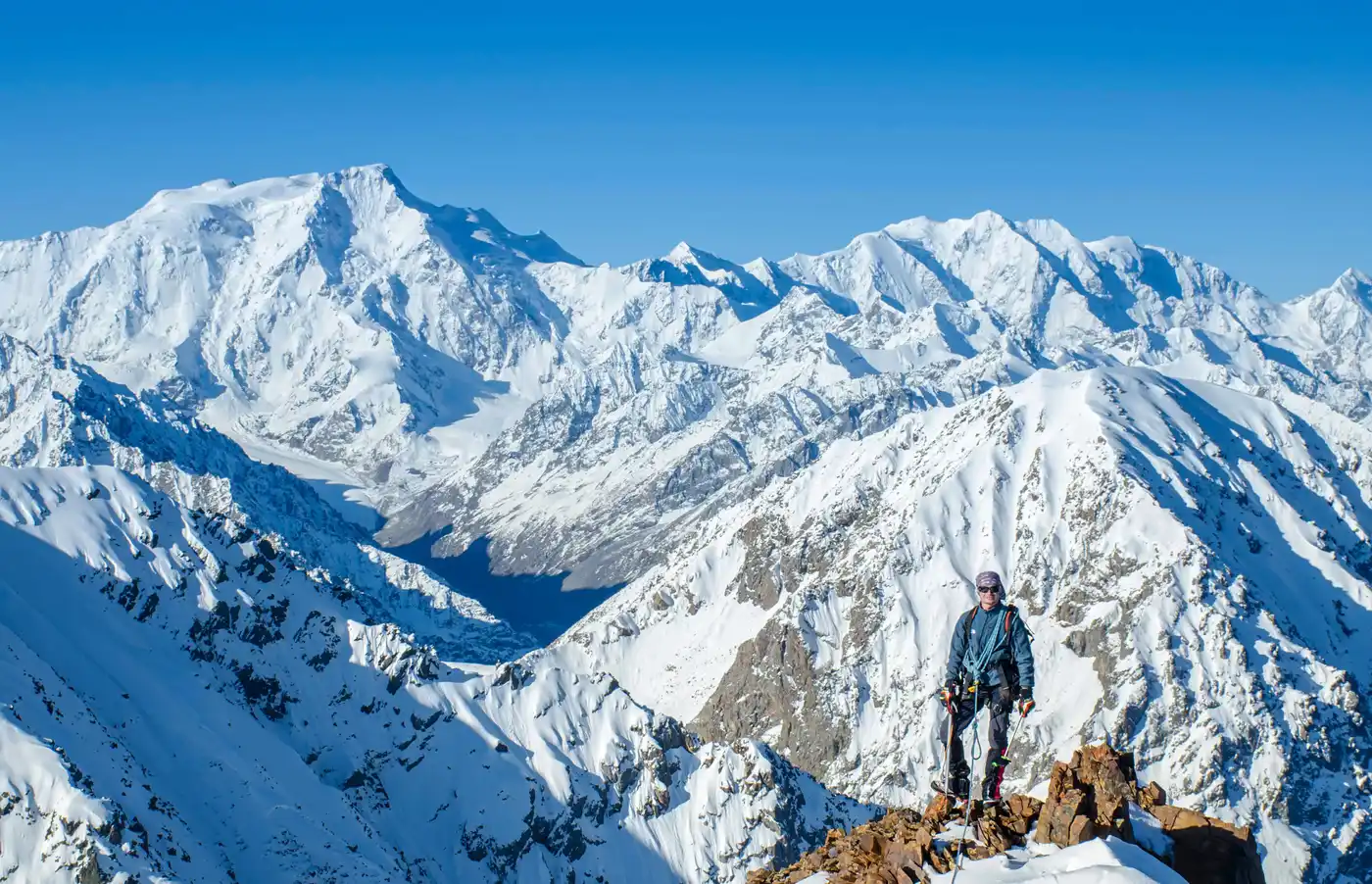
The peak which can be seen from anywhere in the city of Karakol. Peaked rocks framed by snow and ice. There are several ways to conquer the peak. We will go along the easiest and safest route, which does not require any knowledge of mountaineering from the participants. An experienced guide will organize all the technical aspects on his own. An unforgettable view of the surroundings, Lake Issyk-Kul, Lake Alakul and the highest peaks of this region opens from the top. In good weather, you can see the Khan Tengri peak, which is 200 km away from us.
If you have long wanted to try yourself in conquering the top but do not know where and when to start, then you cannot find a better route to go on an unforgettable journey and get an experience!
Please Note: It is necessary to have warm clothes, spare clothes, good boots and spare sport shoes, a rain jacket, sun glasses, sunblock (cream), crampons and ice axel. If you have a specific disease, you should have your own first aid kit with the necessary medicines.Attention:
Tourists must have no medical contraindications for the trekking and hiking.
In case of bad weather, a tour guide has a right to change the route in a safety purpose.
Day-by-day itinerary
Day 1: Manas International Airport, Kyrgyzstan to Karakol, Kyrgyzstan
Meeting at the airport " Manas ". Transfer to the city of Karakol. On the way, stop at a local cafe for lunch (not included in the price, paid on your own). Accommodation in the guest house. Dinner. Meeting with the guide. Meals: -/-/D Detailed information: Minimum altitude: 650 meters Average altitude: 1340 meters Highest altitude: 1700 meters Maximum gradient: -% Average gradient: - % Transfer by car: 380 kilometers Travel time: 7 hours
Day 2: Karakol, Kyrgyzstan to Ala-Kul, Kyrgyzstan
Transfer to the beginning of the walking route. Hiking on the Karakol gorge to the confluence with Kurgator gorge. Lunch on the way. Camp at an altitude of 2900 m. "Orphan camp". Dinner. Meals: B/L/D Detailed information: Minimum altitude: 2040 meters Average altitude: 2330 meters Highest altitude: 2900 meters Walking distance: 14 kilometers Maximum gradient: 35 % Average gradient: 10 % Transfer by car: 8 kilometers Travel time: 6-7 hours
Day 3: Ala-Kul, Kyrgyzstan to Karakol, Kyrgyzstan
Breakfast. Steep climb along the Kurgaktor gorge to the "3 brothers" pass. Lunch on the way. Descent to the glacier, the preparation of the camp. Dinner. Overnight in tents. (3750 m.) Meals: B/L/D Detailed information: Minimum altitude: 2900 meters Average altitude: 3372 meters Highest altitude: 3907 meters Walking distance: 6 kilometers Maximum gradient: 45 % Average gradient: 28 % Travel time: 6-7 hours
Day 4: Ala-Kul, Kyrgyzstan
Breakfast. Climbing to the top (4273 m.). Lunch on the way. Return to the camp. Dinner. Overnight in tents. (3750 m.) Meals: B/L/D Detailed information: Minimum altitude: 3750 meters Average altitude: 3980 meters Highest altitude: 4273 meters Walking distance: 4 kilometers Maximum gradient: 52 % Average gradient: 39 % Travel time: 6-7 hours
Day 5: Ala-Kul, Kyrgyzstan to Ski Paradise Karakol, Каракол, Kyrgyzstan
Breakfast. Descent to the Termitor gorge. Hiking through the pass and descent to the ski base "Karakol". Overnight in forest with panoramic view on Karakol city. Meals: B/L/D Detailed information: Minimum altitude: 2400 meters Average altitude: 3125 meters Highest altitude: 3780 meters Walking distance: 11 kilometers Maximum gradient: 45 % Average gradient: 22 % Travel time: 6-7 hours
Day 6: Ski Paradise Karakol, Каракол, Kyrgyzstan to Karakol, Kyrgyzstan
Breakfast. A short descent to the road, where a car will be waiting for us. Transfer to the southern coast of Issyk-Kul Lake. On the way, we will visit the canyons and a waterfall in the Barskoon gorge. On the way, stop at a road cafe (lunch is paid for by yourself). Accommodation in the yurt camp. Swimming, relaxing on the beach. Dinner. Meals: B/-/D Detailed information: Minimum altitude: 2400 meters Average altitude: 3125 meters Highest altitude: 3780 meters Walking distance: 11 kilometers Maximum gradient: 45 % Average gradient: 22 % Travel time: 6-7 hours
Day 7: Karakol, Kyrgyzstan to Bishkek, Kyrgyzstan
Breakfast. Demonstration of falconry, option. (Not include. 100 USD per group). Transfer to the city of Bishkek. On the way we will visit the Orto Tokoy reservoir. Dinner and accommodation in Hotel. Meals: B/-/D Detailed information: Minimum altitude: 710 meters Average altitude: 1310meters Highest altitude: 2160 meters Transfer by car: 300 kilometers Travel time: 7 hours
Day 8: Bishkek, Kyrgyzstan to Manas International Airport, Kyrgyzstan
Breakfast. Transfer to the Manas airport. End of program. Meals: B/-/- Detailed information: Minimum altitude: 620 meters Average altitude: 720 meters Highest altitude: 750 meters Transfer by car: 23 kilometers
What's included
Transport for the entire program Accommodation in a guest house Karakol Hotel accommodation in Bishkek Accommodation in yurts Meals during the track and stay Porter (for equipment and products) for the duration of the track Taxes and fees Transport to the beginning of the end of the route Tents Sleeping mats Guide Cook
Porter (for personal luggage 20 kg.) 25 USD per day Sleeping bag Meals at the time of transfer Backpack Horse rental Lunch at the ethno cafe Lunch at the roadside cafe
What to know
This tour can be customized. Please get in touch with me.
Route & locations
Manas International Airport, Kyrgyzstan to Karakol, Kyrgyzstan