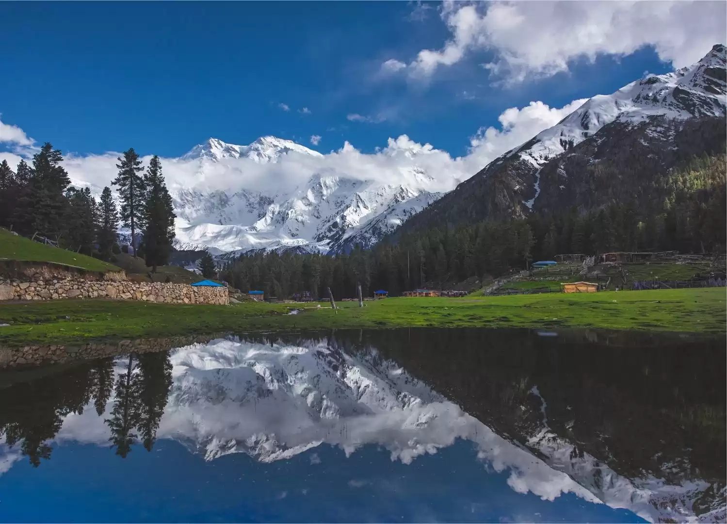
Fairy Meadows 5 Days Trek
About this tour
Fairy Meadows is a grassland near one of the base camp sites of the Nanga Parbat, located in Diamer District, Gilgit-Baltistan, Pakistan. At an altitude of about 3,300 metres (10,800 ft) above sea level, it serves as the launching point for trekkers summiting on the Rakhiot face of the Nanga Parbat. In 1995, the Government of Pakistan declared Fairy Meadows a National Park.
Fairy Meadows is approachable by a fifteen kilometer-long jeepable trek starting from Raikhot bridge on Karakoram Highway to the village Tato. Further from Tato, it takes about three to four hours hiking by a five kilometer trek to Fairy Meadows. The grassland is located in the Raikhot valley, at one end of the Raikhot glacier which originates from the Nanga Parbat and feeds a stream that finally falls in the River Indus. Since 1992, locals have operated camping sites in the area.
Day-by-day itinerary
Day 1: Islamabad, Pakistan to Raikot Bridge
Departure from Islamabad (early morning) Journey through Mansehra, Shinkiari, Battagram on Karakoram Highway (KKH). Crossing through Indus River and passing through Besham, Dasu and Diamer-Bhasha dam sites Night Stay in Chilas
Day 2: Raikot Bridge to Fairy Meadows Cottages
Passage and stops at Tata Pani (hot spring) and change of vehicle at Raikot Bridge Jeep Ride to Tato Village (45mins) Trek to Fairy Meadows (2hrs trekking) Night Stay at Fairy Meadow (camping/huts)
Day 3: Fairy Meadows Cottages to Nanga Parbat Base Camp
Trek to Nanga Parbat base camp Enjoy the walk to wilderness (13000 ft) Short stopover at Biyal Crossing of Glacier Another view of Nanga Parbat Continue trek to base camp Night stay in Fairy Meadow (camping/huts)
Day 4: Fairy Meadows Cottages
Rest and free time for photography, writing etc Enjoy sunrise and sunsets, mirror view of mountains in lakes Night stay in Fairy Meadows (camping/huts)
Day 5: Fairy Meadows Cottages to Islamabad, Pakistan
Departure for Islamabad (early morning) View of Bagrote, Rakaposhi and Haramosh peaks (above 7000m) Arrival in Islamabad End
What's included
What to know
This tour can be customized. Please get in touch with me.
Route & locations
Islamabad, Pakistan to Raikot Bridge