Trekking Around Kol Suu Lake In Kyrgyzstan
About this tour
This trek is really one of a kind trek around Kol Suu lake.
Day-by-day itinerary
Day 1: Manas Airport Road, Ak-Jol, Kyrgyzstan to Bishkek
Arrival in Bishkek, Kyrgyzstan ∣ Early arrival in Bishkek where everyone will be picked up at the airport by your driver. He will have your name written on a name card. ∣ Once you arrive in Bishkek everyone will be able to take a rest and freshen up after the long flight. ∣ After a late breakfast, everyone will go over the tour with their guide and answer any last-minute questions you might have. ∣ The first stop of the day will be at Ala-Too Square where you will start a walking tour of Bishkek. You will be able to visit countless parks, the Osh Bazar, and get to know your guide. ∣ Tonight, everyone will get to know each other at a welcome dinner with a mix of the best local dishes and drinks. Sleeping Altitude: 800 m Driving: ~45 km Driving time: 1.5 hours Accommodation: Guesthouse in Bishkek.
Day 2: Bishkek, Kyrgyzstan to Naryn
Traveling from Bishkek to the Shar Mountain Hut near At-Bashy Village ∣ Today you will be able to see some of the best highlights of Kyrgyzstan, Burana Tower, Lake Issy Kul, and the heart of Kyrgyzstan the Naryn Region. ∣ You will be able to have lunch in the small finishing/shipping town of Balykchy. ∣ During the month of August, it can be ~35 to 40 C in the low attitudes and this makes for a great stop to jump in for a quick swim. ∣ Once you reach the Shar Mountain Hut near At-Bashy you will be able to stretch your legs and enjoy a short hike nearby the accommodation. The accommodation is quite nice with private bathrooms and the location in the mountains is just perfect. Sleeping Altitude: 2,600 m Driving: 350 km Driving time: ~5 hours Accommodation: Shar Mountain Hut Near At-Bashy Village
Day 3: Naryn, Kyrgyzstan to Köl-Suu, Kyrgyzstan
Shar Mountain Hut to Kok Kyia ∣ After waking up in your Yurt you will be able to pack your bags and be ready to head into one of the wildest places in Kyrgyzstan. ∣ First, you will cross the Kaingdy pass and enter into the Kok Kyia / Ak-Sai valley dominated by wild rivers and snow-covered peaks. ∣ When entering the border zone area between Kyrgyzstan and China it’s important to show your passports and border zone permits which will be provided by your guide. (You will not enter China on this trip.) ∣ Once you arrive at the Yurt Camp in Kok Kyia near Kol Suu you will be greeted by Meday’s family. ∣ It’s possible to take a short hike to the summit of a nearby peak to get a great view of the whole area and it’s possible to see Kol Suu lake in the distance. Sleeping Altitude: 3,360 m Driving: 140 km Driving time: 4.5 hours Hiking time: 2.5 hours Accommodation: Meder’s Yurt Camp in the Kok Kyia Valley
Day 4: Köl-Suu, Kyrgyzstan to At-Bashi
Trekking from Meder’s Yurt Camp to an alpine plateau ∣ After an early breakfast then you will start trekking into the mountains. ∣ You will travel north along a Kok-Kiya river where you will arrive in a large alpine plateau at 3,747m where you will have a great panoramic view of the whole area. If the weather is clear you can see the Ak-Say Valley to the west and to the east you can see the border of China. ∣ Lunch will be had from the panoramic point and you will be able to have a clear view of the whole valley. ∣ Later in the day you will continue east towards the border of China alongside a winding and twisting Ak-Say-Uuru river. ∣ Tonight, dinner will be served next to a large river in the middle of nowhere. Sleeping Altitude: 3,445 Altitude Gain: 569 m Altitude Loss: - 472 M Hiking time: ~5 hours ~11 km Accommodation: Night in tents near the Ak-Say-Uuru river
Day 5: Köl-Suu, Kyrgyzstan to At-Bashi
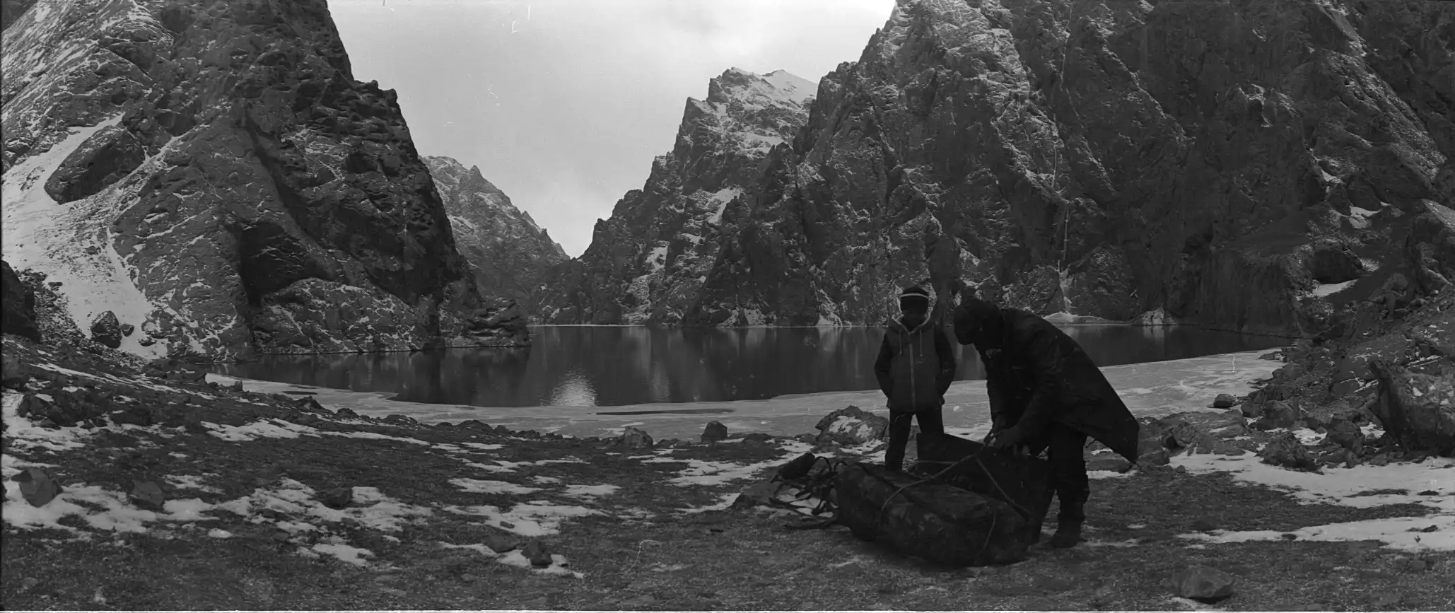
Trekking to Kol Suu over the Eshegart pass at 3,933m ∣ After breakfast, everyone will pack up and leave the Ak-Say-Uuru river valley to reach higher grounds. ∣ Today you will pass thought many rolling hills until you meet the Tuyuk-Boto-Moynok River valley. ∣ After crossing the rocky river then you will make your way over the steep Eshegart Pass at 3,933m. ∣ At the top of the pass, you will be able to see the amazing Kol Suu Lake from a high vantage point. ∣ Making your way down to the Kol Suu lake to spend the night next to Chong Tash on the shore of Kol Suu lake. Sleeping Altitude: 3,519 Altitude Gain: 1,046 m Altitude Loss: -972 m Hiking time: ~8.5 hours ~ 18 km Accommodation: Tent camp at Chong Tash
Day 6: Köl-Suu, Kyrgyzstan to At-Bashi
Chong Tash via the 5 boys Mountain Valley ∣ After breakfast, you will be able to enjoy the stunning view of the Kol Suu lake. ∣ Leaving Chong Tash you will make your way on the path of the sheep where you will pass by the mountain hut called 5 boys. ∣ Lunch will be at the pass at 3,490m. The final stop of the day will be near a shepherds hut at the headwaters of the Tuyuk-Boto-Moynok River valley. Sleeping Altitude: 3,490 m Altitude Gain: + 525 m Attitude Loss: -549 m Hiking time: ~6.5 hours 14 km Accommodation: In tents near the shepherd's house near the headwaters of the Tuyuk-Boto-Moynok River Valley
Day 7: Köl-Suu, Kyrgyzstan to At-Bashi
Headwaters of the Tuyuk-Boto-Moynok River valley to Kol Suu ∣ Today it will be important to have an early breakfast because you will have lots of ground to cover. ∣ Walking alongside the Tuyuk-Boto-Moynok River you will keep to the south side of the river until you meet the back door mountain valley to Kol Suu. You will make your way over a small unnamed pass before reaching Kol Suu for the night. ∣ Once you reach Kol Suu you will be able to see the amazing 800 m cliffs surrounded by cristal clear lake. ∣ Only the brave will dip into the lake for an ice-cold swim. ∣ Tonight you will have dinner in the tent camp next to the shoreline of the Kol Suu lake. Sleeping Altitude: 3,568 m Altitude Gain: + 565 m Altitude Loss: - 479 m Hiking time: ~7.5 hours ~16 km Accommodation: In tents near Chong Tash on the east side of Kol Suu lake
Day 8: Köl-Suu, Kyrgyzstan to Naryn, Kyrgyzstan
Hiking from Kel Suu lake back to Kok Kyia + Naryn Town ∣ After breakfast, you will pack up your gear and make your way back to Meday’s yurt camp. ∣ Arriving at the Yurt camp sometime before lunch where you will be able to pack up your bags and get ready for the drive to Naryn town. ∣ The last day of hiking is going to be an easy one but it’s also set up as a flexible day just in case there is poor weather in the mountains. ∣ After lunch, everyone will be able to say goodbye to Meder’s family at the yurt camp. ∣ On the way to Naryn town, it’s possible to make a stop at a mysterious waterfall which is a great roadside stop between Kol Suu and Naryn town. ∣ Once you arrive in Naryn town everyone will be able to take much-needed shower and clean up after the big trek. ∣ Dinner will be had at a café in Naryn town. Sleeping Altitude: 2,020 m Altitude Gain: + 44 m Altitude Loss: - 235m Hiking time: ~3.5 hours ~7 km Driving: 150 km Driving time: 4.5 hours Accommodation: Guesthouse in Naryn Town
Day 9: Naryn, Kyrgyzstan to Bishkek, Kyrgyzstan
Naryn Town to Bishkek City ∣ After breakfast, everyone will be able to have a short walk through the frontier town of Naryn. ∣ Naryn Town is the regional capital of the Naryn Region. The Naryn region is well known for long traditions of grazing animals such as sheep, yaks, and of course countless horses. ∣ Once everyone is ready you will head back to Bishkek. ∣ It’s possible to make a 3-hour hike at Konorcheck Canyons or spend more time at Osh Bazaar to pick up gifts for friends back home. *The guide will make the final decision. ∣ Once you arrive in Bishkek you have the chance to pack your bags and get ready for your flight tomorrow. Sleeping Altitude: 800 m Driving: ~ 5 hours Driving time: 340 km Accommodation: Blue Camel Guesthouse in Bishkek
Day 10: Bishkek, Kyrgyzstan to Manas Airport Road, Ak-Jol, Kyrgyzstan
Transfer to Manas International Airport and fly back home ∣ After an early breakfast, everyone will be provided with transport to the airport. ∣ Alex at Indy Guide hopes you enjoyed your trip to Kyrgyzstan and we hope to see you again.
What's included
- experienced English-speaking guide - all transportation in private vehicle 4WD minivan - airport transfers - all meals as written in the program - mineral water & tea - accommodation as described in the program - camping equipment (tents, sleeping mats, kitchen utensils, gas) - all activities mentioned in the program - your contribution to our sustainable development projects - organization of the trip
- international flights - travel and repatriation insurance - alcohol and soft drinks - personal equipment rental (sleeping bag, headlight, water bottle etc...) - personal expenses - tips (always optional, always appreciated)
What to know
What should I bring with me? - travel backpack for your main stuff (60-80L) - light backpack for your daily stuff (20L) - sleeping bag (comfort -5/-10°C)* - headlight - hat/beanie - sunglasses - sunscreen/lipstick - personal hygiene and medication set - hiking shoes - hiking bottle - warm clothes for cold evenings (maybe freezing at night at Son Kul) - fleece - light gloves - scarf - waterproof mountain jacket (wind stopper) - camera + batteries - your good mood
Route & locations
Manas Airport Road, Ak-Jol, Kyrgyzstan to Bishkek