Fergana Valley And Its Authenticity - 2 Days
About this tour
The North Pakistan, especially Gilgit-Baltistan is blessed naturally with luxuriantly green orchards (mostly of cherry, apricot, apple, pears, peaches), streams full of dancing waters, roaring rivers, and meadows stretching in the quietude like that of heavens at a height which, is a unique feature of Pakistan’s northern areas. The juniper, pine and Deodar are the trees that, in their trunk rings, have recorded the cycles of rainy and snowy seasons of centuries
The areas are abounding in colorful flowers along with gushing streams, roaring water falls, particularly in Hunza.
One can find pink, white, red, yellow, blue flowers, dancing, everywhere in the northern areas during Autumn season.
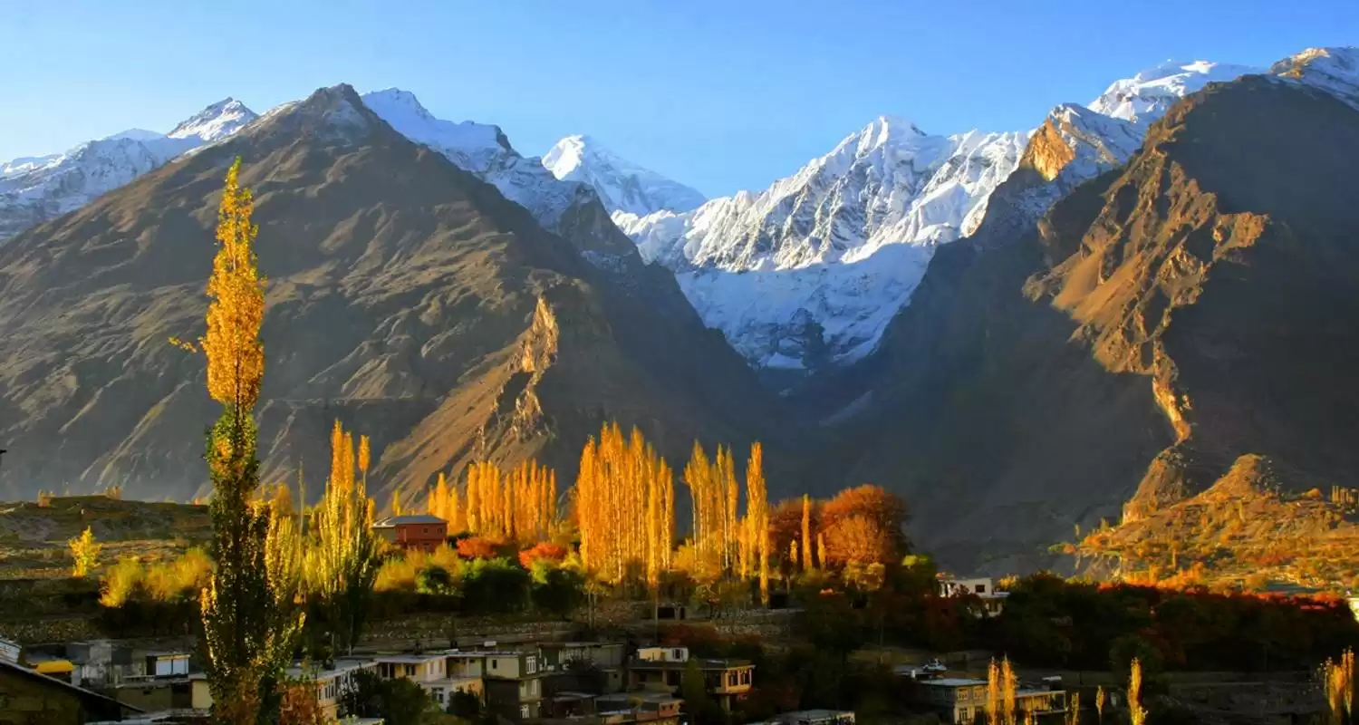
Autumn in Northern Areas of Pakistan is something to be hold. This is the time of year when the trees of poplar, apricot, mulberry, peach, apple and plum burst forth into a riot of color with hues of orange, rust and red. The clear and bracing weather offers the best view of the surrounding mountains
Day-by-day itinerary
Day 1: Islamabad, Pakistan to Rawalpindi, Pakistan
Islamabad is new capital 47 years old well-planned city of Pakistan is lush green at the footsteps of Potwar hills. Visit one of the biggest Shah Faisal mosques in the world; also an interesting round trip combines a tour of Shakespearian Park with a visit to Lok versa, the institute of Folk and Traditional Heritage. Rawalpindi is a lively, bustling city with the crowded streets and colorful bazaars, thorough it lacks the grand monuments; nonetheless, the bazaar should appeal to anyone with the desire to see the real Pakistan. Meals: Breakfast O/N Guest House
Day 2: Islamabad, Pakistan to Khewra Salt Mine, Khewra, Pakistan
Khewra city famous for having world’s second largest salt mines (Khewra Salt Mines) is located in District Jhelum of province punjab, Pakistan. The city is situated about 200 kilometres (124 miles) from Islamabad and 245 kilometres (152 miles) from the city of Lahore. Khewra Salt Mines are located 945 feet (288 meters) above sea level. The mountains containing Khewra Salt Mines are part of mineral-rich mountain range called Salt Range. Total length of Salt Range is 300 kilometres (186 miles), extending from Beganwala near River Jhelum to Kalabagh near River Sindh. Width of Salt Range varies between 8 kilometres to 30 kilometres. It is a major tourist attraction, drawing up to 250,000 visitors a year
Day 3: Islamabad, Pakistan to Chilās
Karakorum high way is 8th wonder of the world (KKH). KKH is the highest paved international road in the world. It connects China and Pakistan across the Karakoram mountain range, through the Khunjerab Pass, at an elevation of 4,733 m/15,397 ft. It connects China's Xinjiang region with Pakistan's Gilgit-Baltistan and Khyber Pakhtunkhwa regions and also serves as a popular tourist attraction. Due to its high elevation and the difficult conditions in which it was constructed, it is also referred to as the "Eighth Wonder of the World
Day 4: Chilās to Fairy Meadows Cottages
Nanga Parbat (8125m), the world's ninth- highest peak and the second-highest of Pakistan's five 8000m peaks, is the west¬ernmost peak of the Great Himalayan range. With a 20km long series of peaks and ridges, Nanga Parbat forms a huge mas¬sif. Its solitary white appearance, visible from the south for at least 100km, prompted its name, which means `naked mountain' in Urdu. It's also known as the 'Killer Moun¬tain' because of the difficulties moun¬taineers have in reaching its summit. Beside the glacier are pine and fir forests, sparkling streams and open grass¬lands that have enchanted visitors and prompted the name Fairy Meadow.
Day 5: Fairy Meadows Cottages to Gilgit
The various waves of invaders that passed through lower Pakistan also reached Gilgit. The animism of the early inhabitants gave way to fire worship brought in from Iran. Later the Aryan invaders introduced an incipient from of Hinduism from the first century BC Gilgit, like Kashgar, was an important staging post on the silk Route from China. The Kargha Buddha was carved in the 7th century. A monastery and three Stupas about 400m near Buddha were excavated in1931 and written in Sanskrit. We follow right beside the Indus from Skardu and view the incredible force of the river by the deep gorges it has carved out. We then join the Karakoram Highway (KKH) which was built by the Chinese over twenty years and runs from Kashgar to 'Pindi.
Day 6: Gilgit to Hunza, Hunza Nagar
The Hunza Valley is a mountainous valley, situated north/west of the Hunza River, at an elevation of around 2,500 metres. The territory of Hunza is about 7,900 square kilometres (3,100 sq mi). Aliabad is the main town, while Baltit and Altit are popular tourist destination because of the spectacular scenery of the surrounding mountains
Day 7: Hunza, Hunza Nagar to Gulmit
High mountains of 5500m to 7785m, with a unique color of surround Gulmit Brown, green and white, this unique cultural place lies on the Right Bank of Hunza River. Khunjerab Pass elevation 4,733m is a high mountain pass in the Karakoram Mountains in a strategic position on the northern border of Pakistan's Gilgit-Baltistan region and on the southwest border of the Xinjiang region of China. Its name is derived from Wakhi 'Khun' means Home and 'Jerav' means spring water/water falling. The Khunjerab Pass is the highest paved international border crossing in the world and the highest point on the Karakoram Highway.
Day 8: Hunza, Hunza Nagar to Skardu
The rising of Indus stretches down to Baltistan valley from Tibet to Gilgit and down to the Arabian Sea, which cuts the Indian sub continent from Asia; Baltistan valley is called a little Tibet in the North of Pakistan. Baltistan is situated at the last end of Himalaya, beside Deosai Plain and Satpara Lake. Baltistan the tourist destination of Mountains paradise where the world 2nd highest peak is K-2 (8611-m) and the other 8000m are Broad Peak, Gasherbrum-I & II Likely 8068 to 8047m and there are many peaks 7750- 7800m
Day 9: Skardu to Khaplu
This handsome village of timber-and-stone houses and precision-made dry walls climbs up a wide alluvial fan beneath an arc of sheer granite walls. Painstaking irrigation has made it a shady, fertile oasis. As you climb its twisting track, the icy peaks of the Masherbrum Range rise on the other side of the valley. It’s hard to imagine a more majestic setting near a public road anywhere in Pakista
Day 10: Skardu to Shigar
The gateway to the great mountain peaks of the Karakorams, Gasherbrum & K-2, is only 23 km away from Skardu via jeep road. Shigar valley’s gentle, irrigated slopes are filled with terraces of wheat, maize and barley. Its orchards of apricots, mulberries, peaches, plums, pears, apples and nuts are unique to Baltistan. The wooden mosque in the middle of the town was built by Kashmiri carpenters several hundred years ago. Shigar Fort Residence has been open since June 1, 2005, following an intensive six-year restoration undertaken by Aga Khan Cultural Service Pakista
Day 11: Skardu to Kharpocho Fort, Skardu
Kharpocho means The king of Forts is a fort in Skardu city in Gilgit-Baltistan region of Pakistan that dates from the 16th century CE. For construction of this Engineering Miracle of that age goes to the famous ruler of Gilgit-Baltistan Ali Sher Khan Anchan (1560 – 1625 AD).
Day 12: Skardu to Besham City, Pakistan
drive back
Day 13: Besham City, Pakistan to Islamabad, Pakistan
full day drive
What's included
all services
personal is personal
What to know
Golden Autumn
Route & locations
Islamabad, Pakistan to Rawalpindi, Pakistan