Journey Through Mangistau - 7 Day Tour
About this tour
Karynzharyk, Bozzhyra, Tuzbair, Caspian Sea
Activities included
Day-by-day itinerary
Day 1: Aktau, Kazakhstan to Karynzharyk, Kazakhstan
Onere Spring Karynzharyk Depression Overnight in tents Onere Spring Water from the spring flooded the surrounding area, forming three small lakes with crystal-clear water. The entire area around the spring is a small desert oasis. Wild animals, wolves, foxes, and goitered gazelles, flock to the spring, and birds also flock here, allowing you to observe the wildlife. Karynzharyk This is a desert basin stretching 130,160 km from north to southwest, 2,440 km wide, and covering an area of 2,000 km². Sand hills formed by the crushing of primary rocks reach 515 meters in height. Some areas have become salt lakes and salt marshes.
Day 2: Senek, Kazakhstan to Gora Bokty (Mount Bokty), Kazakhstan
Sands of Tuesu (dunes) Mount Bokty Kyzylkup (tiramisu) Overnight in tents
Day 3: Beket Ata underground mosque, Kazakhstan to Urochishche Bozzhyra, Kazakhstan
Oglandy Beket-Ata (underground mosque) Boszhyra (3 upper panoramas) Boszhyra (lower panorama) Overnight accommodation (in tents) Bozzhyra Tract Bozzhyra Tract is one of the most beautiful places in Kazakhstan, a complex of rock formations of varying sizes and shapes. It is located at the bottom of a vast canyon in the western part of the Ustyurt Plateau on the Mangyshlak Peninsula. Bozzhyra is a majestic creation of the Ustyurt Plateau's natural elements.At this point, the plateau drops steeply into a cascade of clay-limestone steps. This natural formation is called a clink. Nature has given free rein to its imagination and created an unearthly landscape in white chalk tones. Beket-Ata Mosque The mosque, a 17th-century religious and memorial monument, is carved into the rock and consists of five circular chambers, with a mihrab niche in the far southwestern chamber.
Day 4: Bozzhyra View Point 7, Kazakhstan to Tuzbair, Smotrovaya Ploshchadka 1, Kizyl-Bas, Kazakhstan
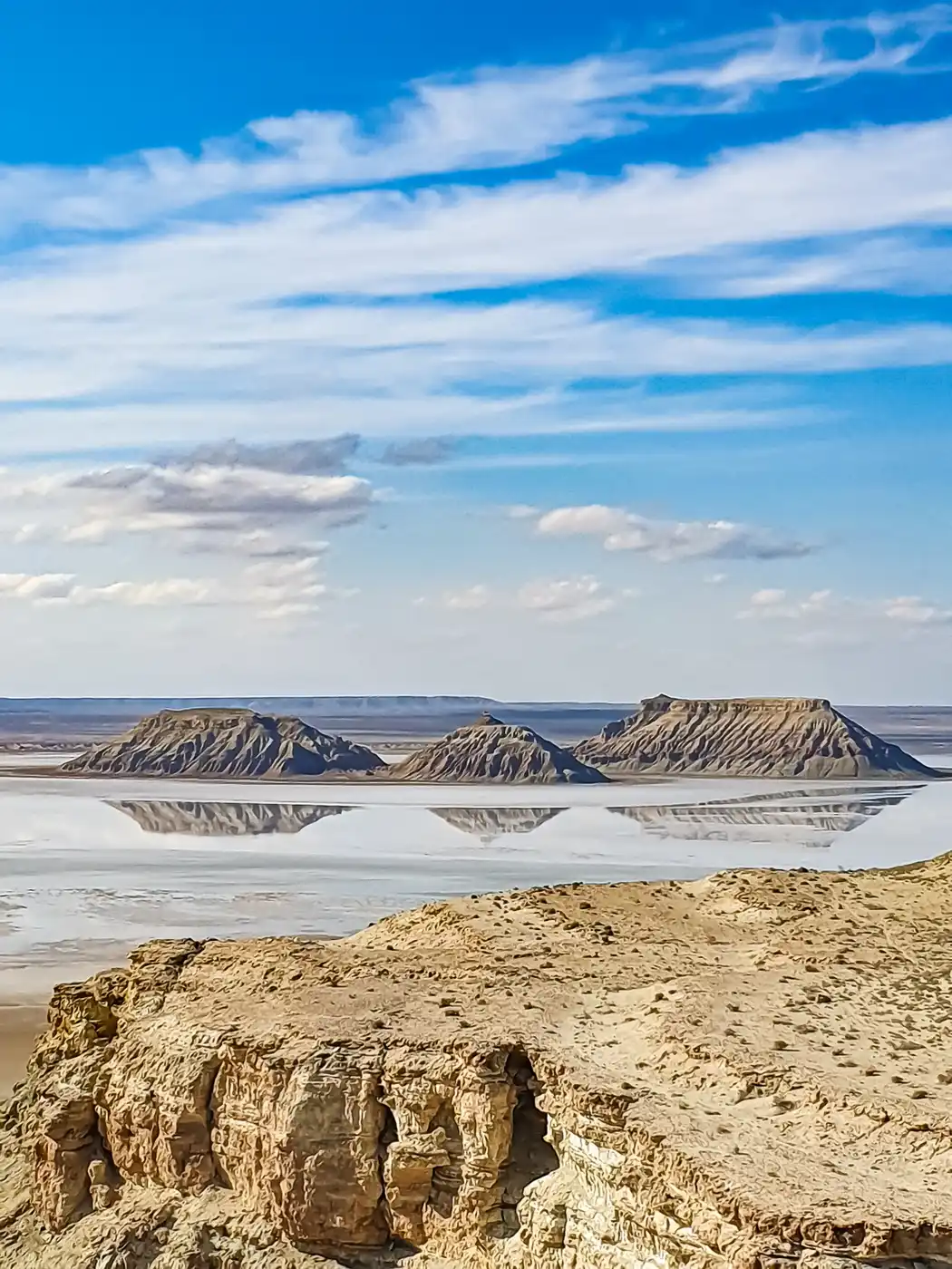
Bozzhyra (middle panorama) Gorge with bird nests Tuzbair (lower panorama) Overnight in tents. Tuzbair Soro Tuzbair Soro is a salt marsh. In Kazakh, it's called "sor," which refers to a type of salt marsh that has no drainage and is shallow. Soros form in depressions no more than one and a half meters deep. During the spring thaw, the salt marsh is covered with a smooth surface, picturesquely reflecting the sky.In summer, the crust hardens, and you can walk freely—only occasionally will your feet sink into the salt deposits to a depth of 1015 centimeters. Therefore, when walking on the surface of the salt marsh, you should wear rubber boots or other waterproof footwear with high tops.Or, alternatively, walk barefoot. Another landmark of Tuzbair is a natural chalk arch resembling nostrils.
Day 5: Ushchel'ye Ybykty, Koyulus, Kazakhstan to Airakty, Shetpe, Kazakhstan
Karaman-Ata (underground mosque) Ybyktysay (lace-like canyon) Ayrakty Shomanay (valley of castles) Overnight stay (in yurts in the ethno-village of Kogez) The Karaman-Ata Underground Mosque, 12th century. The underground mosque is carved into the gentle slope of a hill. A natural cave was likely used for its construction. The structure comprises three main rooms: a vestibule, a 236-square-meter prayer hall, and a circular chamber where, according to legend, Karaman-Ata is buried.The rooms are connected by a long corridor. The ceiling height in all rooms is low. The prayer hall's ceiling is supported by two solid and three man-made columns. To provide lighting, two round skylights have been cut into the ceiling. Ybykty Sai Canyon Ybykty Sai Canyon is a collection of limestone cliffs with unique, bizarre shapes. Their height ranges from 3 to 6 meters. Airakty Shomanay (Valley of Castles) The area around Airakty resembles a mysterious desert city with ruined outcrops that resemble towers and castles with spires.
Day 6: Sherkala, Kazakhstan to Shakpak Ata Necropolis and Underground Mosque, Ashchimuryn, Kazakhstan
Sherkala Kokala Torysh (Valley of Balls) Kapamsay Gorge Shakpak-Ata (Underground Mosque) Overnight at the Visitor Center rysh Torysh The area is also known as the Valley of Balls due to the spherical concretions found on the surface, ranging in diameter from 1015 cm to 4 meters. These concretions, 40 to 60 million years old, formed on the floor of the ancient Tethys Ocean. Kokkala Ravine The ravine is famous for its bizarre erosion of variegated and colored clays and the mountain gorge with spring water located in the immediate vicinity. Nature has miraculously eroded the clay layers.creating a layered mountain of hummocks, columns, mushrooms, pyramids, and miniature canyons with intricately jagged sides. Kokala is a natural splash of color among the monotonous rocky mountains of Mangystau. The Kokala tract represents a unique time tunnel into the Jurassic period, which existed more than 140 million years ago. The Karatau mountain fold, rising from the Earth's depths, lifted layers that were buried beneath a thick layer of ocean sediment. Sherkala Sherkala is a solitary mountain of unusual shape. Viewed from one side, it resembles a huge white yurt, but from the other, Sherkala resembles a sleeping lion, resting its enormous head on its paws. The name Sherkala comes from the Persian, meaning "Lion Fortress." Kapamsay Canyon A river once flowed at the bottom of the canyon, but it has dried up over time. At great depth, trees grow among the flint rocks, providing shade and coolness on hot summer days.
Day 7: Zhygylgan Hollow, Dzhigalgan, Kazakhstan to Aktau, Kazakhstan
Zhygalgan (fallen earth) Lake Kuzdykary (heart) Saura Canyon Saura Beach Return to Aktau
What's included
Transfers along the route - accommodation in prepared SUVs driver-guide camping equipment rental (tent, sleeping pad, sleeping bag); double occupancy meals (breakfast, lunch, dinner) served on-site and at roadside cafes; drinking water throughout the entire route Accommodation in an ethno-village and visitor center
Flight to Aktau; Airport transfer Accommodation in Aktau Insurance
What to know
This tour can be customized. Please get in touch with me.
Route & locations
Aktau, Kazakhstan to Karynzharyk, Kazakhstan